
Grade 6 - Exploring the Ocean
SUMMARY
A 5-7 Week Science Unit for Middle School Level.
This unit is designed for sixth grade, but could be adapted for 5th-8th grades. Students learn about the exploration of deep sea canyons, seamounts, and the Bering Sea. They develop an understanding of how technology is used to explore the ocean by participating in a deep sea sampling simulation, creating a bathymetric map, and assuming the role of scientists using hydrophones to locate whales. They then explore their local waters using sampling techniques to discover the plants and animals. Finally, they explore a new ocean topic and present their knowledge to others.
Essential Questions
- How can technology help us explore the ocean?
- Why do we want to explore the ocean?
Enduring Understandings
- The ocean is largely unexplored.
- Humans must use ingenious ways to study the ocean.
- Exploration leads to discovery.
- Science and technology can be used to detect and solve problems.
Ocean Literacy Principle Addressed
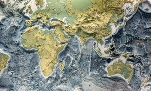
- The Earth has one big ocean with many features.
- The ocean makes Earth habitable.
- The ocean supports a great diversity of life and ecosystems.
- The ocean and humans are inextricably interconnected.
- The ocean is largely unexplored.
LESSON PLANS
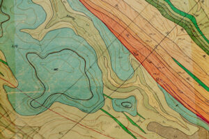
Bathymetric Mapping
This activity will help students understand the lines and colors found on a bathymetric map or chart. It introduces them to contour maps–both bathymetric and topographic–and it introduces them to the geologic features that many explorers study. Bathymetric mapping is a major part of many of the Ocean Explorer expeditions since our understanding of the ocean floor starts with knowing what it looks like.
View Lesson Plan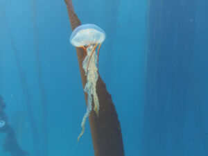
Canyons in the Sea
In this 5-7 day investigation, students learn about vehicles used to explore the sea. They then learn about two deep sea canyons in the Bering Sea and the variety of life found in these canyons. Finally, students create a mural of one of the canyons, and participate in a sampling simulation to determine life in the canyon.
View Lesson Plan
Location: Classroom
Activity Type: Multimedia, Project
Mapping the Sea Floor
This activity leads students through a process of creating a model of the ocean floor, taking depth “soundings,” entering data into an Excel spreadsheet, and then creating a 3-D map of their ocean floor in Excel.
View Lesson Plan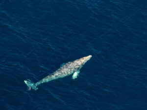
Searching for Sounds in the Sea
This 3-day investigation begins with students listening to a variety of underwater sounds, and deciding if the sound was made by an animal or something else. They learn about sound and how sound works in water, and about a researcher in the Bering Sea who is using sound to study the North Pacific right whale. Students learn about hydrophones and participate in an activity that simulates the use of hydrophones. Finally, they learn about spectrograms and try to identify animals by looking at the spectrograms and listening to the associated sounds.
View Lesson Plan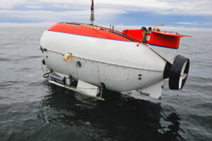
The Excitement of Exploration
Students begin this 3-4 day investigation with a discussion and activity centered around seven traditional reasons that people explore. Then they go on an imaginary journey to the unknown. Once the journey is over, the students are given clues to discover that their trip was in a manned submersible in the Bering Sea. They learn about a researcher who is actually studying the Bering Sea in a submarine, then watch and discuss a video featuring underwater explorer Robert Ballard. As a final activity in this investigation, students research past and present ocean explorers and share their discoveries, inventions, or research.
View Lesson Plan
Location: Classroom
Activity Type: Multimedia, Project
AUTHORS
Holly Debenham, Fairbanks North Star Borough School District
Rebecca Himschoot, Sitka School District
Joni Scharfenberg, Fairbanks
Stephanie Hoag, Curriculum Consultant, Juneau
Marilyn Sigman, Science Content Specialist
Marla Brownlee, Alaska Sea Grant